Select for tips:

You can select any of the sections by clicking the relevant link below; the panel that opens will give some help on the chosen section.


 Map overlays

 Journey Planner

 Locks

 River conditions

 Weather

 Bridges

 River draft

 Help/Advice


Tap the matching icon for relevant tips


Close

Add any combination of:

Marinas/boatyards, Moorings, Pumpout, Fuel, Elec Charging, Bridges, Slipways, Pubs, Fishing, Camp sites, Lock names, Emergency RVPs (all locks are shown by default).

On the interactive map, tap (bottom left) and choose the overlays you want

Any icon now displayed as a map overlay can be tapped to reveal a popup with more information


Next Tip

Select Thames or Wey Planner:

On the Thames planner select those river sections you wish to view (can be preset in Settings at bottom of page)

Tap your starting point and the Planner will display the Destination points - select where you are going

The details of your journey will display in a popup with the sailing time (at 1, 2, 3, 4, and 5 MPH), river (sailing) distance and number of locks to transit

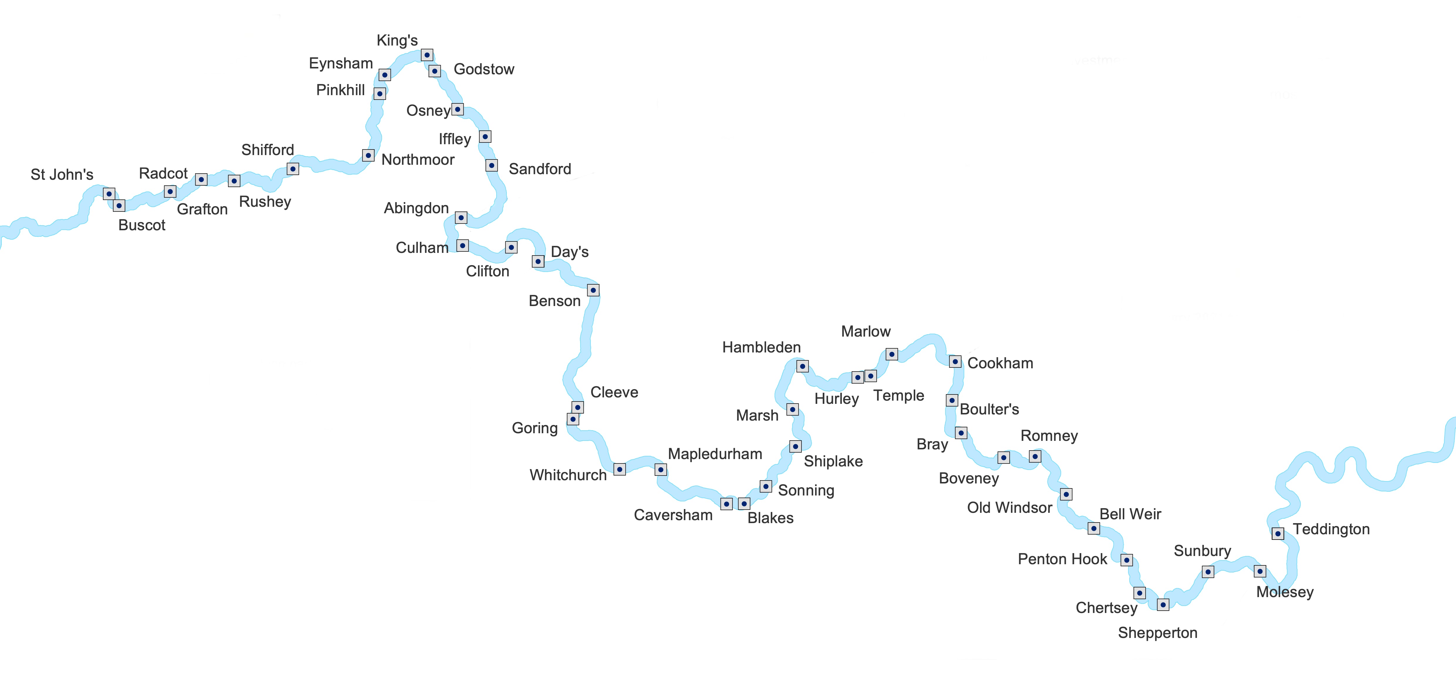
Tapping 'show on map' will open the interactive map with your journey highlighted (Thames Planner only)


Next Tip

Select Thames or Wey Locks:

Every lock is shown in river order

Click on 'More' to see full details for the selected lock (name, phone, post code, drop, width, length, operation type, facilities at this lock* and keeper's hours) - *including water, WC, pump-out, showers, rubbish disposal, recycling, electric charging, camping, fuel, slipway, short term mooring

Tapping 'Show on map' will open the interactive map with the selected lock highlighted


Next Tip

Always check before sailing!

You can follow links to download and display the current conditions for the non-tidal and tidal Thames or the Wey

Conditions are shown on external sites so an Internet connection is required (for conditions by phone see Advice/Tools)

Be aware of red and yellow boards (on the non-tidal Thames) and fluvial flows (on the tidal Thames) - links on this page provide popups to explain red/yellow boards and fluvial flows


Next Tip

Live weather forecasts for selected locations on the Thames and Wey

Tap the location for which a forecast is wanted

Forecasts are downloaded from external sites so an Internet connection is required

The weather page calculates and displays the correct time to strike your Ensign (2100 or sunset whichever occurs first); this is hidden after a few seconds


Next Tip

Check clearances for masts etc

For each bridge the headway (clearance between water and underneath of bridge) is shown (also see special procedure for transiting Tower Bridge)

Headway for tidal Thames' bridges is shown for high water


Next Tip

Check clearances beneath your keel

The expected draft (depth of water) in the central third of the river (the 'fairway') is shown for the non-tidal Thames and Wey (depth on the tidal Thames is tide-dependent)

Remember the draft of your boat (the distance between the waterline and the keel) when verifying sufficient depth


Next Tip

On any page tap the black icon mid-bottom then tap 'About', 'Advice' or 'Help'

Advice:

The four top sections (Where am I, Man Overboard, In an emergrency, and Fire, sinking, Illness) are to help when something goes wrong

The remaining sections cover a range of information and useful topics to ensure you carry out your sailing in safety and according to the rules laid down by the river authorities

Information provided includes Navigation Aids, Sound Signals, Flag Signals, Flag Etiquette and a searchable glossary of Boating Terms

Tap whichever section you wish to read; if you are new to boating it will make sense to read some of the Advice sections before your first trip!

About:

Provides a link to email the author alongside copyright, version info, disclaimer and privacy notice; a link to the app support site is also available here

Help:

Provides context-sensitive assistance for the page from which it is opened


Your Ensign

Your ensign should be struck (lowered) at the earlier of sunset or 2100 local time. The correct time is shown on the home page

it is illegal for a British merchant vessel to fly the Union Flag; British merchant vessels are encouraged to fly the Red Ensign; some vessel masters (not the vessel itself) are entitled to fly one of the variants of the Blue Ensign

It is improper for a foreign merchant vessel to fly the Union Flag; the correct courtesy flag is the Red ensign (although a commissioned warship may fly the White Ensign as a courtesy flag)

Only a commissioned Royal Navy warship may fly the Union Flag but only on the vessel's jackstaff; the correct ensign for such a vessel is the White Ensign