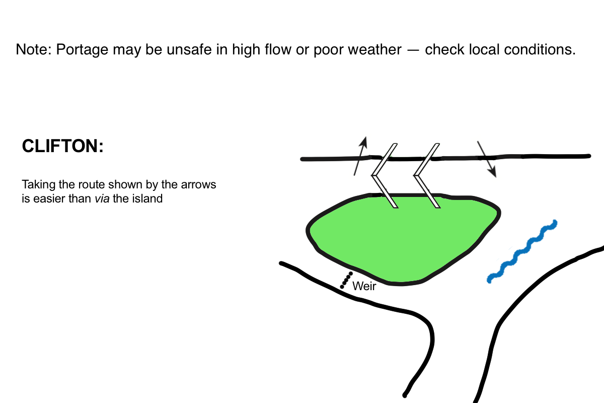
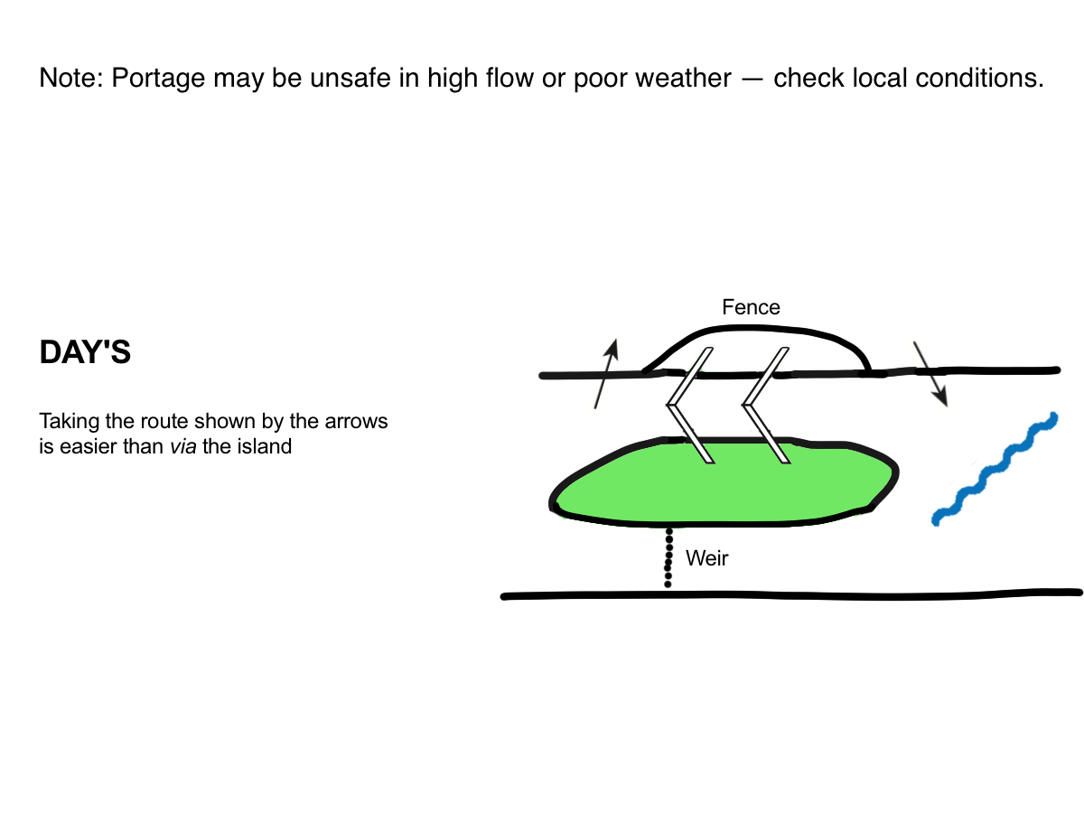
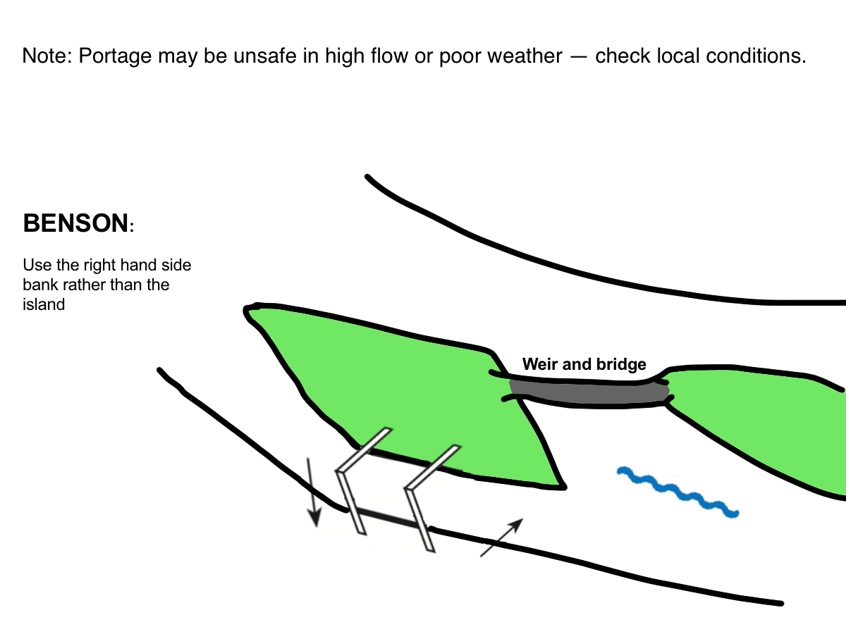
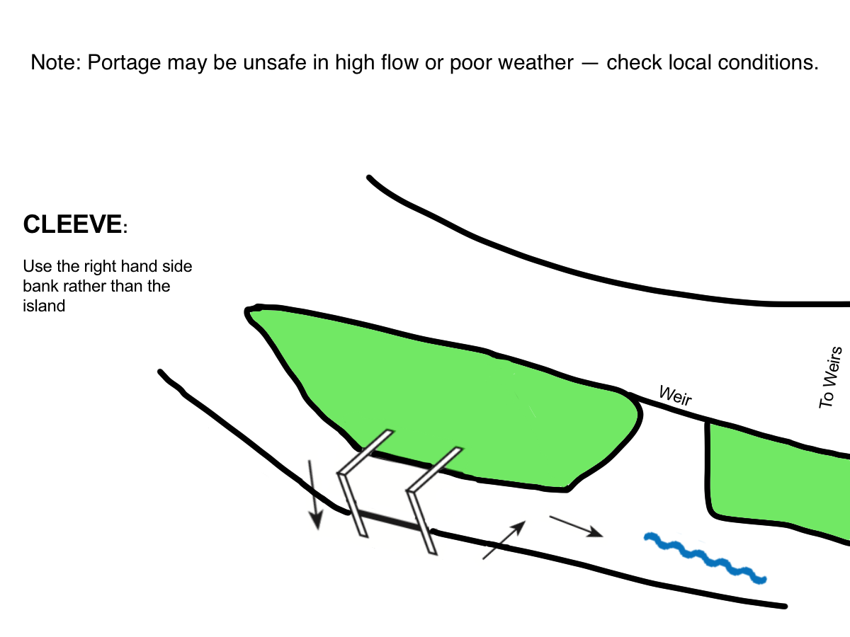
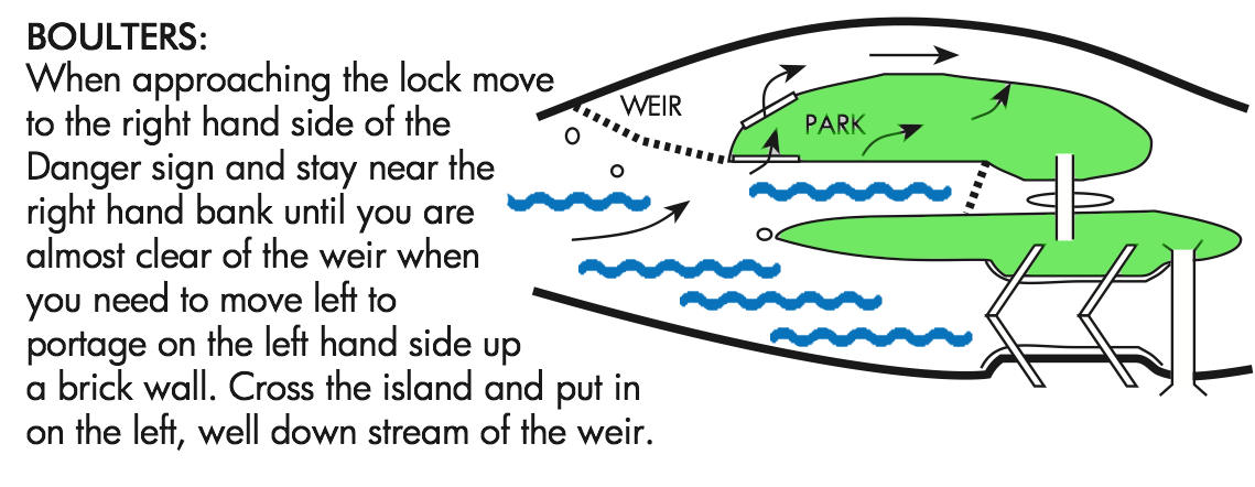
Select map overlay(s):
-
Locks
-
Boatyards/Marinas
-
Fuel
-
Charging
-
Moorings
-
Bridges
-
Slipways
-
Food*
-
Lodging*
-
Pubs*
-
Fishing
-
Sanitation (pump out)
-
Camping Sites
-
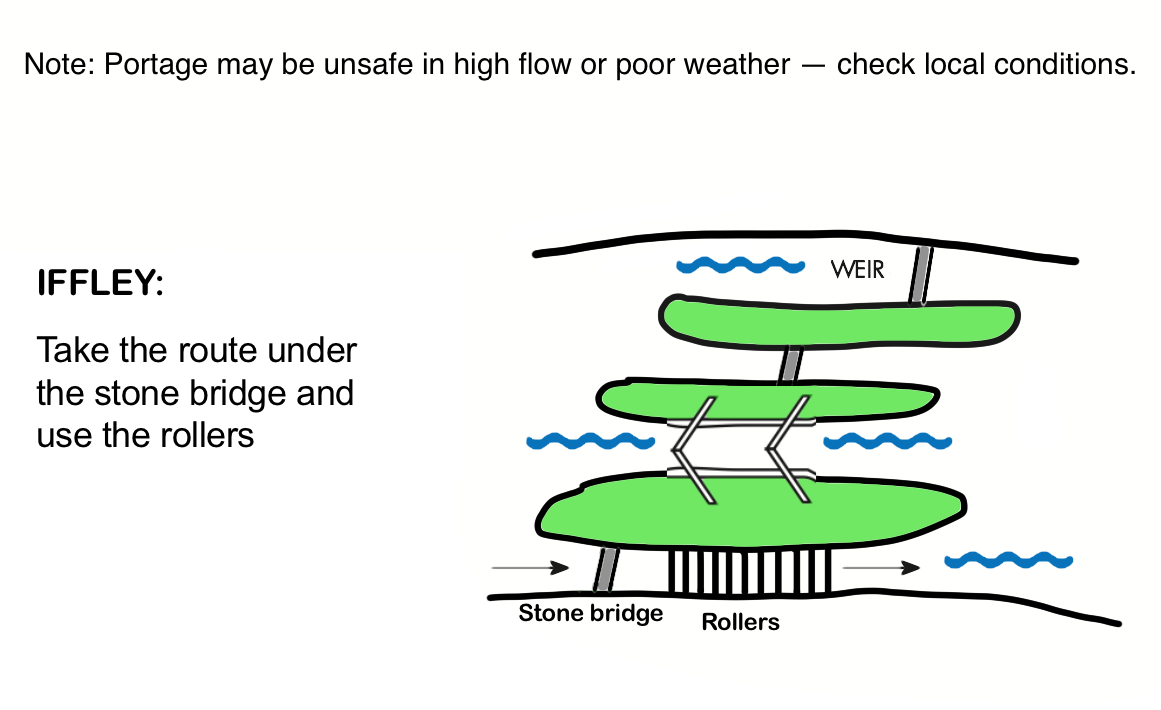
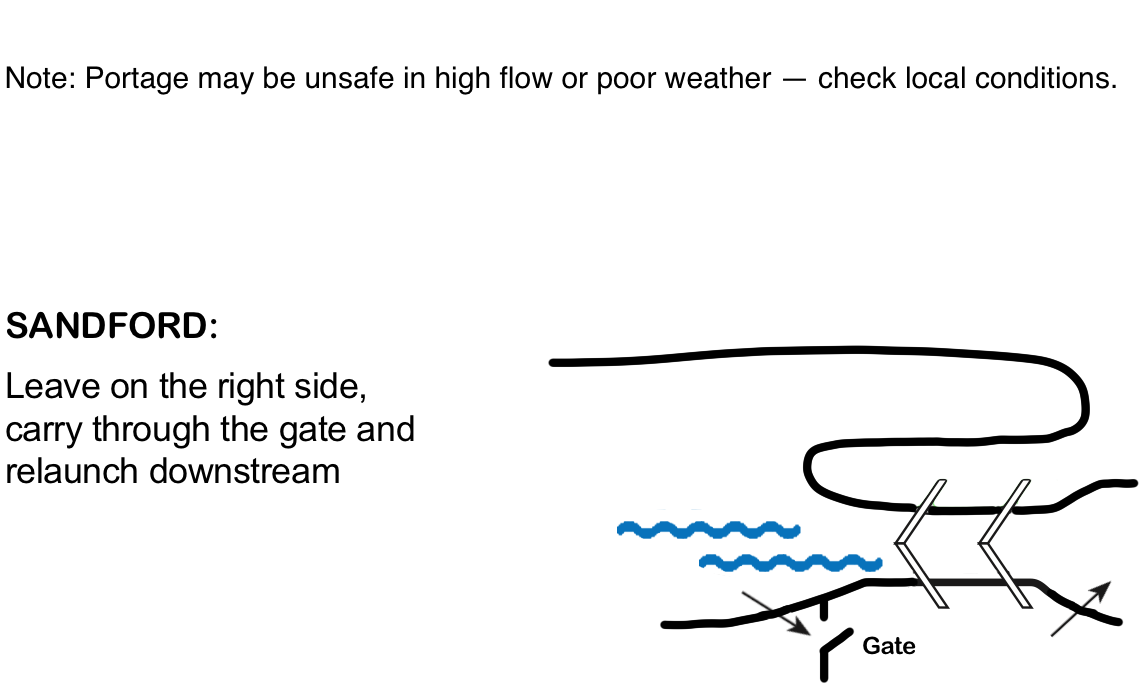
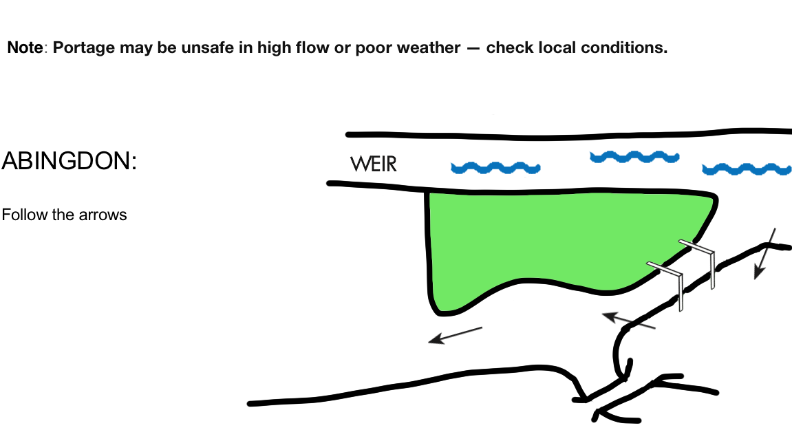
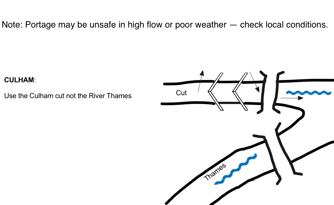
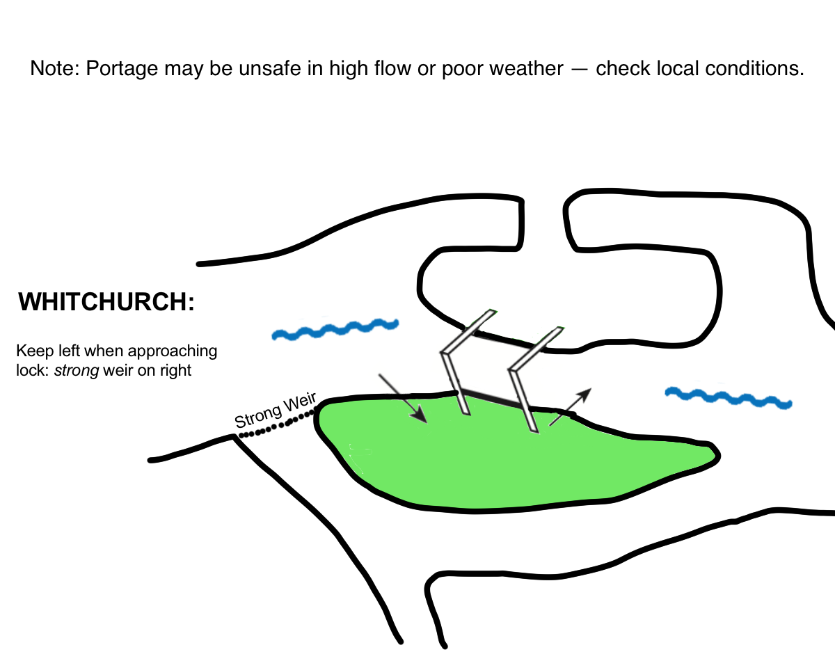
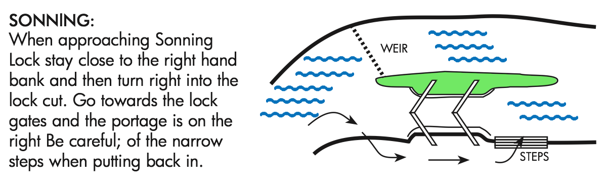
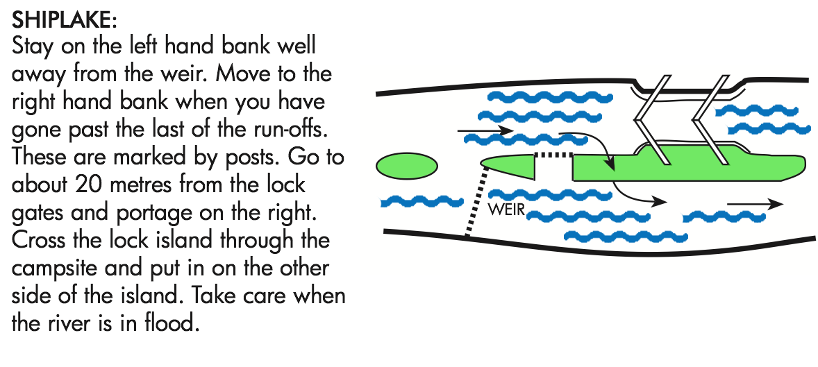
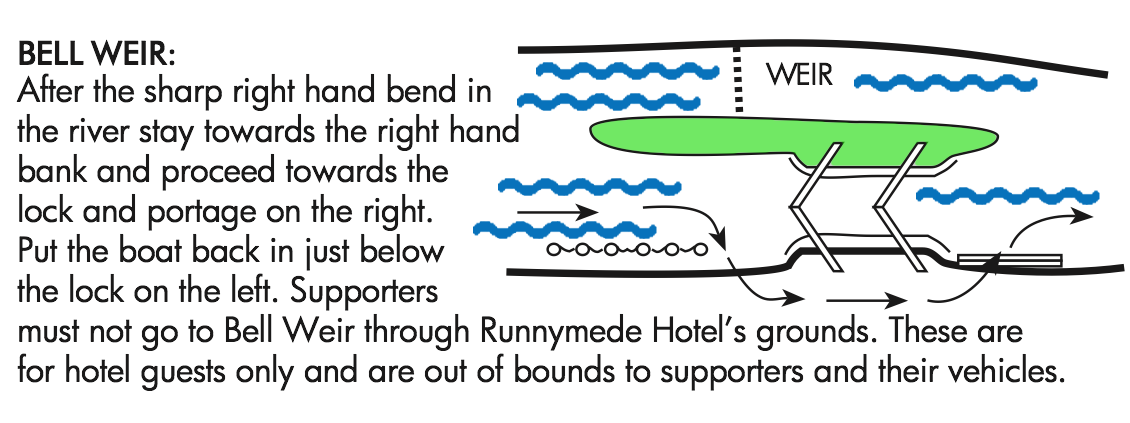
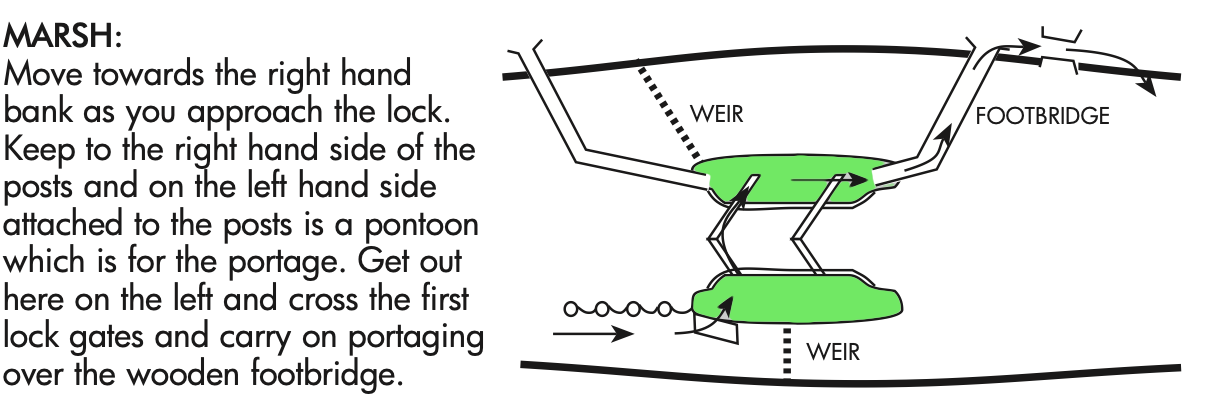
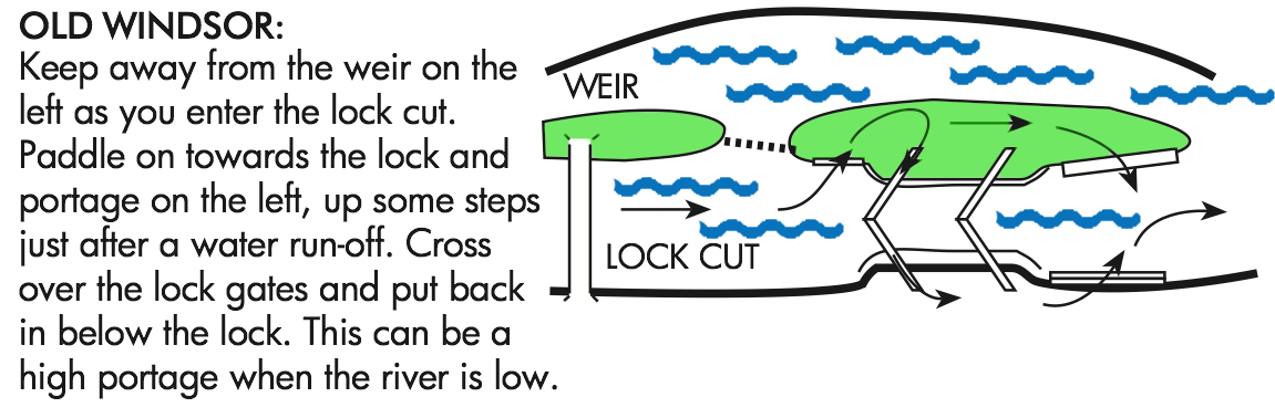
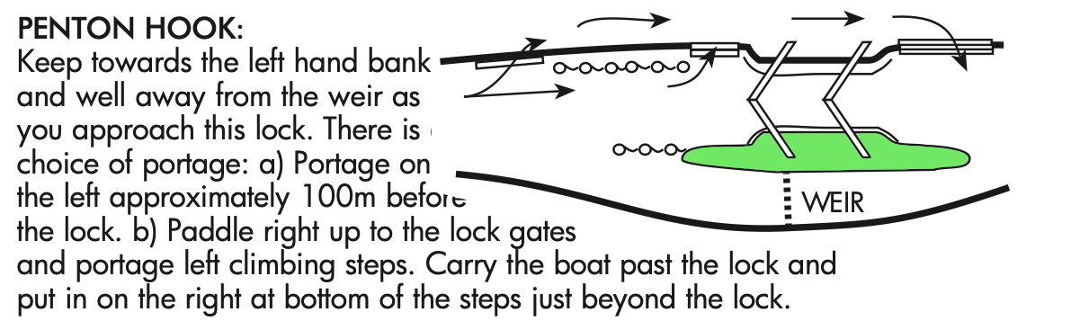
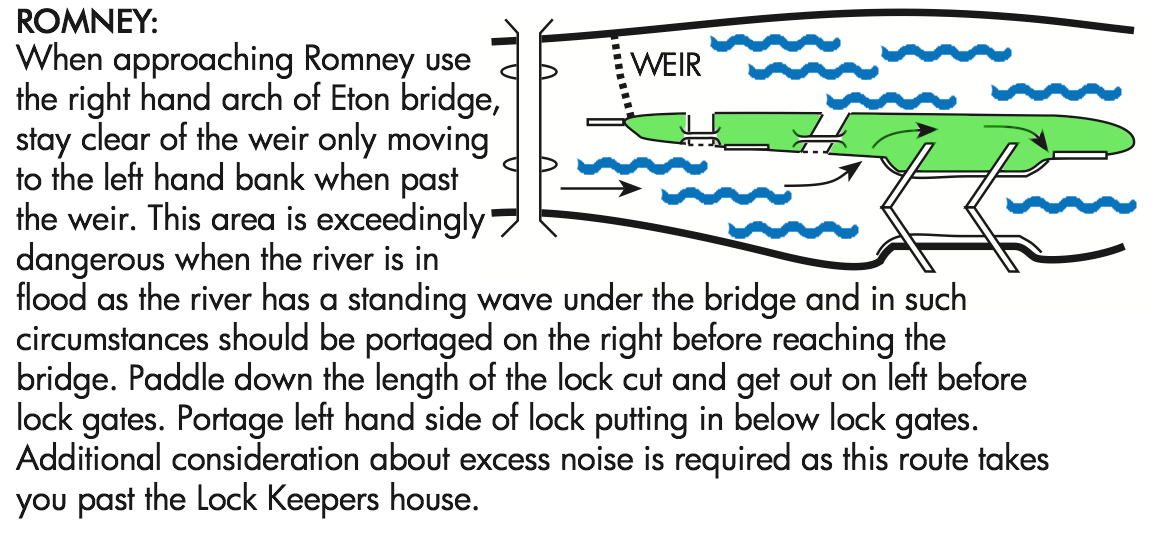
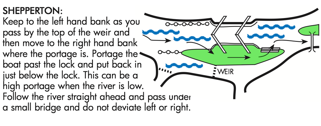
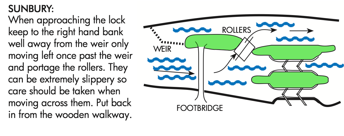
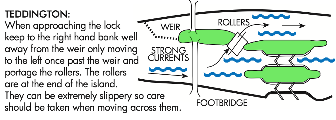
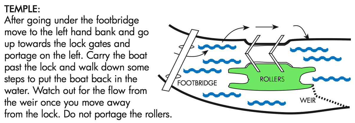
Lock Names
-
Thames Path (in orange)
-
Emergency RVP
* on the river or a short walk from moorings
You can select/deselect as many overlays as you need Individual overlays can be removed by tapping them here All overlays can be removed by tapping 'Clear All' Resize this panel by dragging the right edge